Under Salt Marsh
Digital capture for VFX on Sky Atlantic’s Welsh crime thriller
Under Salt Marsh is a six-part crime thriller for Sky Atlantic, set in a Welsh village caught between rugged mountains and an encroaching sea. Atmospheric and character-driven, the series intertwines a central murder investigation with an environmental narrative rooted in the real threat of coastal flooding in Wales. Writer-director Claire Oakley makes striking use of the North Wales landscape, from brooding marshlands to sweeping mountain vistas, with filming centred around the village of Fairbourne. The setting is integral to the drama, reinforcing both the village’s isolation and the mounting tension. As an approaching storm threatens to cut the community off entirely, the worsening conditions mirror rising grief, suspicion and unresolved history, resulting in a moody, deliberate series driven by strong performances and a powerful sense of place.
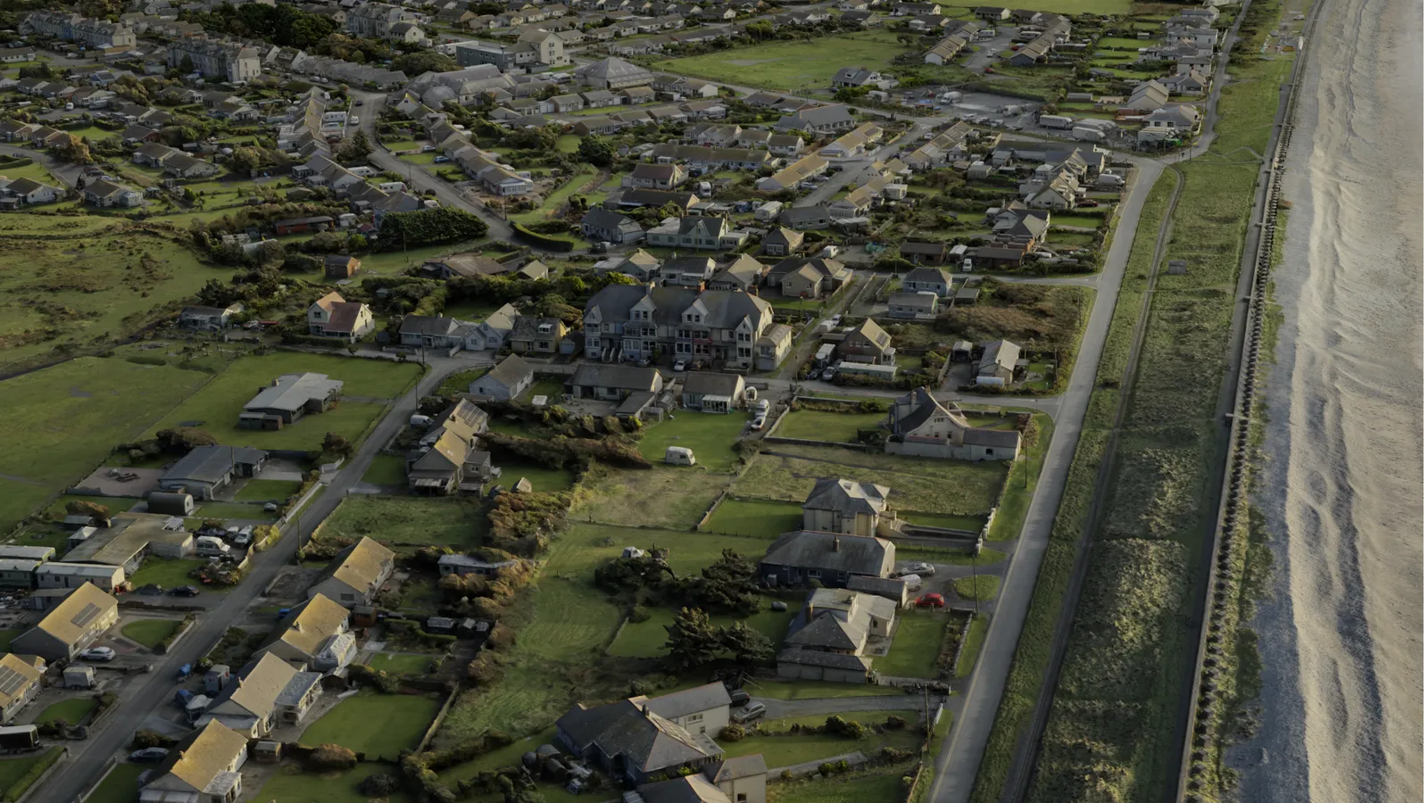
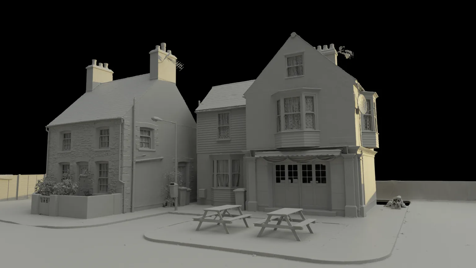
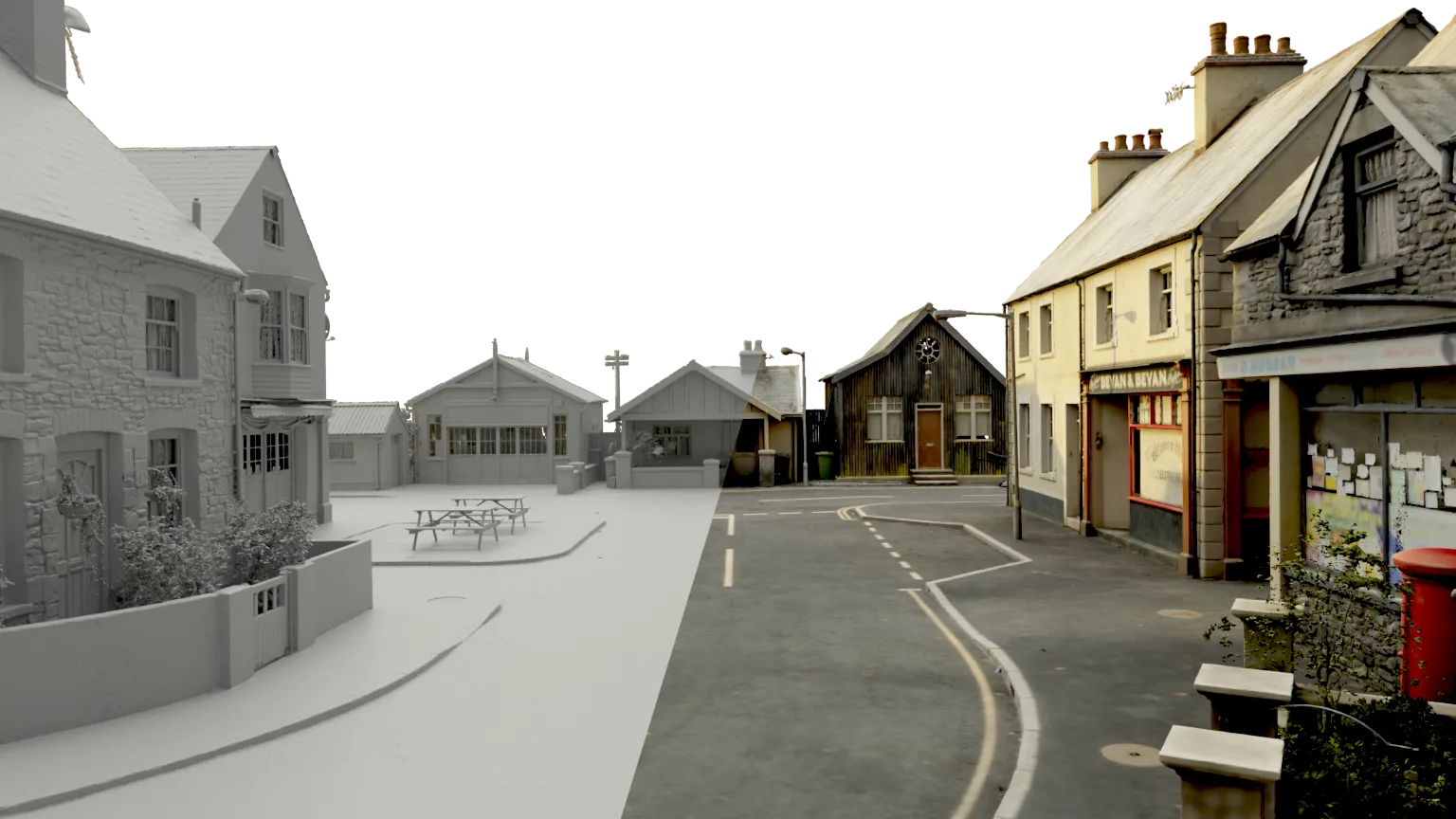
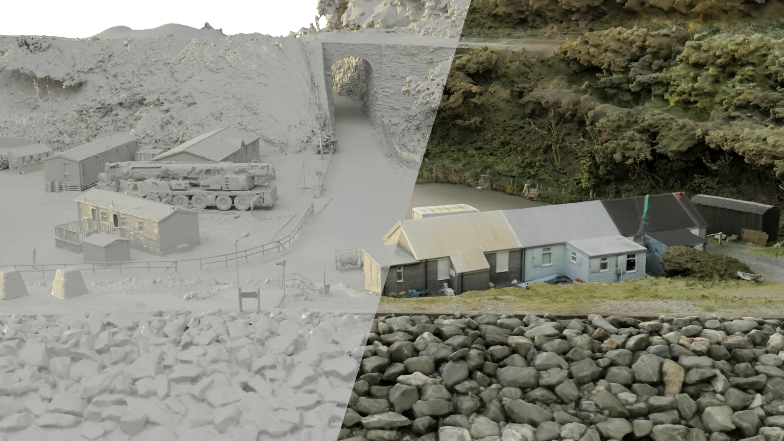
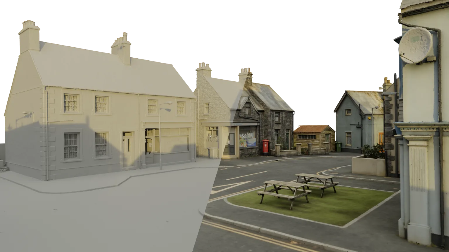
Mark Harris and the crew at Milk VFX were tasked with delivering the complex yet invisible 3D visual effects needed to transform Fairbourne into the storm-battered, catastrophically flooded fictional village of Morfa Halen, as well as the island setting that underpins the series. This required us to digitally capture and model Fairbourne in its entirety to enable Milk to augment the live action shots with tempestuous CGI seascapes. In parallel, we digitised a purpose-built set constructed at Dragon Studios in Cardiff. Built on a specially engineered concrete pad, the set was designed to be flooded in-camera by the SFX team, with the resulting footage subsequently enhanced and extended through detailed CGI work by Milk.
Our Toolbox
To expedite this work we have a sophisticated, comprehensive and integrated toolbox of both hardware and software. Broadly our hardware divides into a full suite of Unmanned Aerial Vehicles (UAVs), state-of-the-art Terrestrial Laser Scanning (TLS) technology and high-resolution cameras that we use up in the air and down on the ground.
We maintain a fleet of UAVs with a wide variety of payloads; cameras to cover landscapes and structures photogrammetrically, video cameras and SLAM technology LiDAR scanners. TLS is an established measurement technology that is widely adopted across a variety of industries and applications. Rapid technological developments since the initial introduction of laser scanners has made them faster, more accurate and easier to use. Our Sony mirrorless, interchangeable-lens, α7 series cameras combine high image quality with great portability.
It is clear that no single software package fulfills every processing need. The multiple software we employ divides into packages that enable us to collect and register data in the field and those that allow us to process and visualise the results of the initial data acquisition.
Spatial data collected by TLS is initially registered in proprietary processing software such as Trimble Realworks and Leica REGISTER360; which can accurately articulate hundreds of individual scanner set ups. The resulting point cloud comprises many hundreds of millions of individual points, each precisely located in space and containing both intensity and RGB values.
Adobe Lightroom software allows us to organise and manipulate the large volumes of RAW image data we collect with our multiple camera sensors. Image processing involves a number of stages, but broadly they cover colour correction with reference to a Macbeth Colour Chart and balancing the exposure to create consistency across the data set.
All spatial and visual data is then brought into Epic Games RealityScan (RS). Its algorithms enable the simultaneous alignment and processing of TLS data, ground photography, and drone images in a single step, producing a mesh that is both metrically accurate and richly detailed.
On Location - Fairbourne
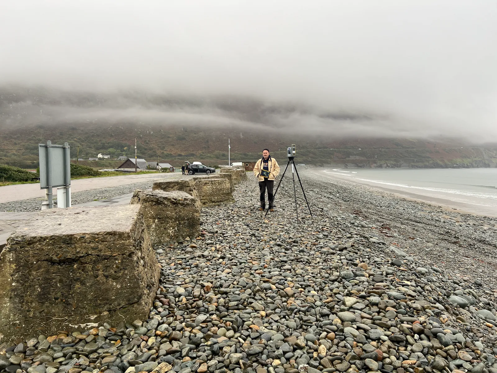
Over the course of the work in Fairbourne, a tripod-mounted Trimble X9 laser scanner was positioned in and around the village to collect 308 separate scans at overlapping cardinal locations. Each of these 360° scans was collected with full RGB colour, something which later facilitated the accurate alignment of the TLS point cloud and images in RS during post-processing. Additionally, 13,700 aerial images were captured at various altitudes from a range of drones.
Following the registration of the TLS set ups in Trimble Realworks and the post-processing of all the images in Lightroom, the data was input into RS. A ‘first pass’ model was calculated using only the aerial photogrammetry images, enabling the team to check coverage in only a few hours. Subsequently the full 3D model was calculated from a carefully selected 15,350 inputs, comprising a mix of TLS point clouds and images. Final delivery to Milk was a number of different resolution OBJ models with UDIMs and multiple textures.
Fairbourne Village
Data captured on location across the village
308
Lidar Scans
1,342
Terrestrial Images
13,700
Aerial Images
15,350
Combined input to final model
Dragon Studios - Cardiff
On a cloudy day at Dragon Studios we used our Leica RTC360 laser scanner positioned in and around the set to collect 127 separate textured scans. Tripod mounted Sony α7Riv cameras were used to capture over 890 images of the set from multiple overlapping angles. Additionally, 1,800 aerial images were captured with our DJI Mavic 3 Classic.
The TLS set ups were registered in Leica REGISTER360 software and the images processed in Lightroom before the data was once more input into RS. The fully textured 3D model was finally calculated from 3,350 inputs and delivered as OBJ files with UDIMs and multiple textures.
Dragon Studios, Cardiff
Data captured on the purpose-built studio set
127
Lidar Scans
890+
Terrestrial Images
1,800
Aerial Images
3,350
Combined input to final model
What our clients say
I couldn’t be more impressed with the quality and accuracy of the work Duncan and Jandira delivered. The rendered scan of an entire Welsh town served as a fantastic base for our DMP work, and the Bridgend street set scan was pixel perfect - critical in matching our virtual cameras and rendered fully into reframed shots. Aside from being world-class at what they do, they’re both thoroughly lovely people to work with. I can’t wait for the next opportunity to use this amazing team again.
Let’s talk about your project
Whether you have a fully-defined brief or you’re exploring options, we’re happy to discuss your needs. Every project starts with understanding what you’re trying to achieve.
Get in touch